


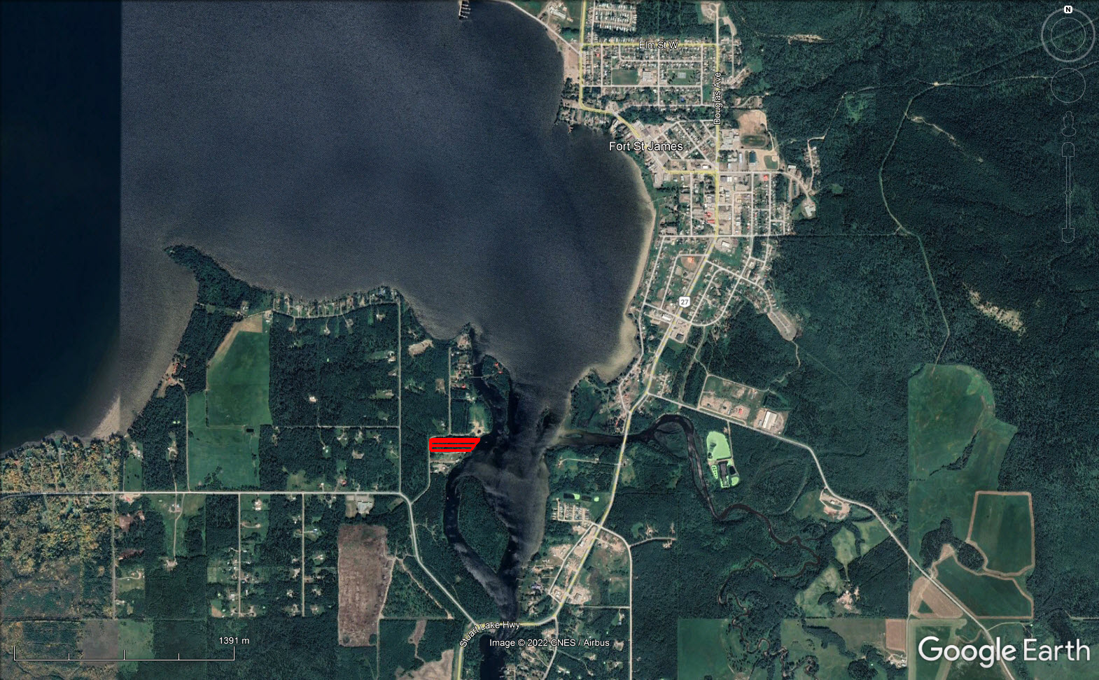
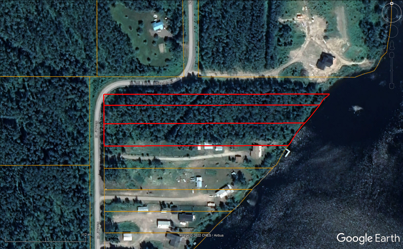
Facing beautiful Stuart Lake and only minutes to town. Three gently sloping lots sold as one package. Build one home or three . . . Beautiful view.


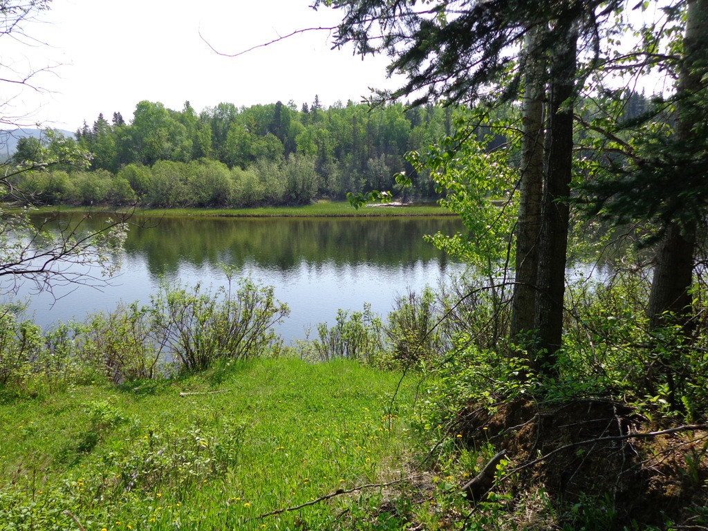

Gently sloping from west to east down to the lakefront/riverfront. All three contiguous lots have good road access along Sweder Road with power, paved road and gas available. There is also an undeveloped 66 foot road allowance along the north boundary of Lot 11. These lots are only minutes from central Fort St. James. The three lots are being offered as one package. They are not sold individually.
Total 5.4 acres and approx. 300’ along the water
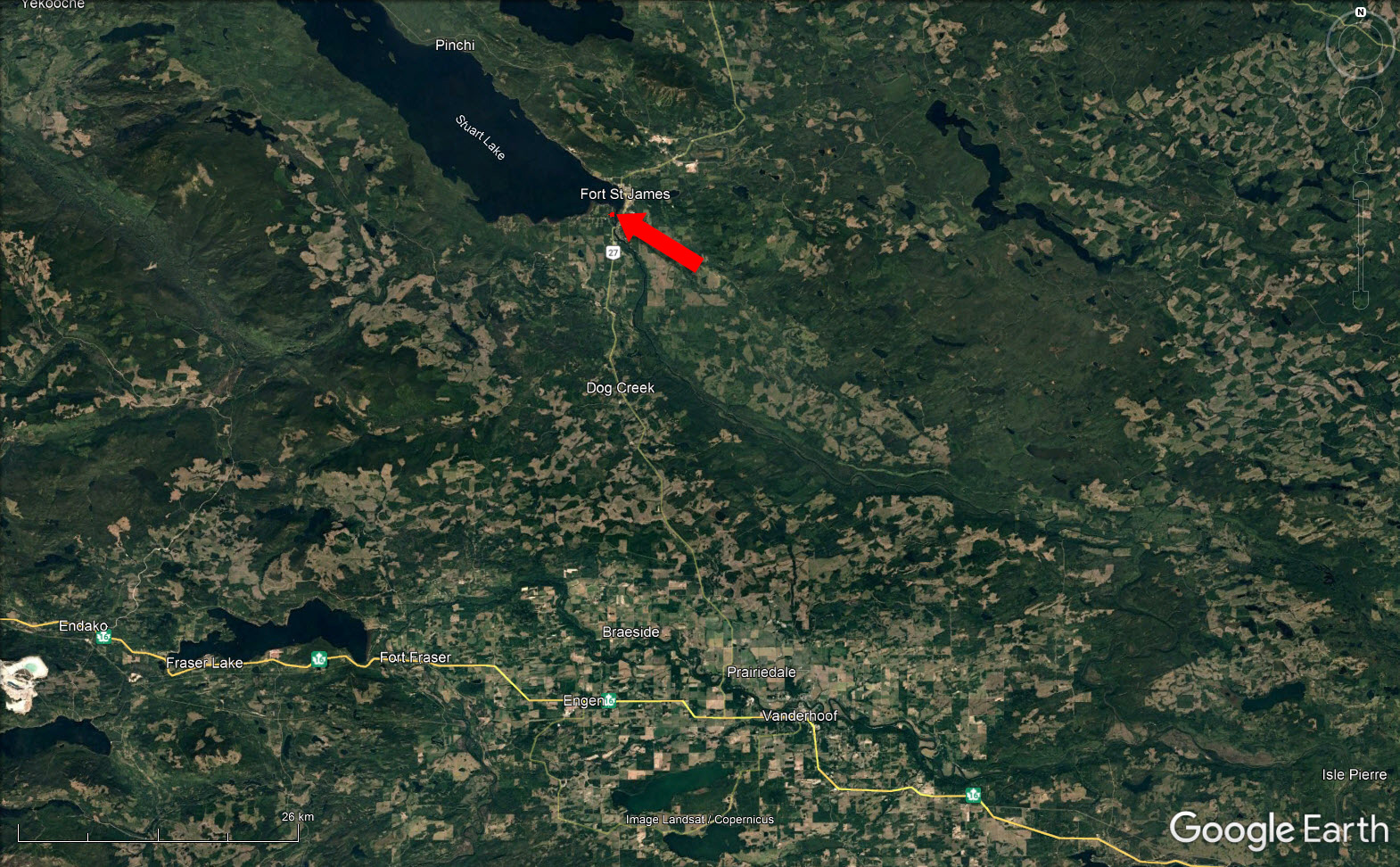
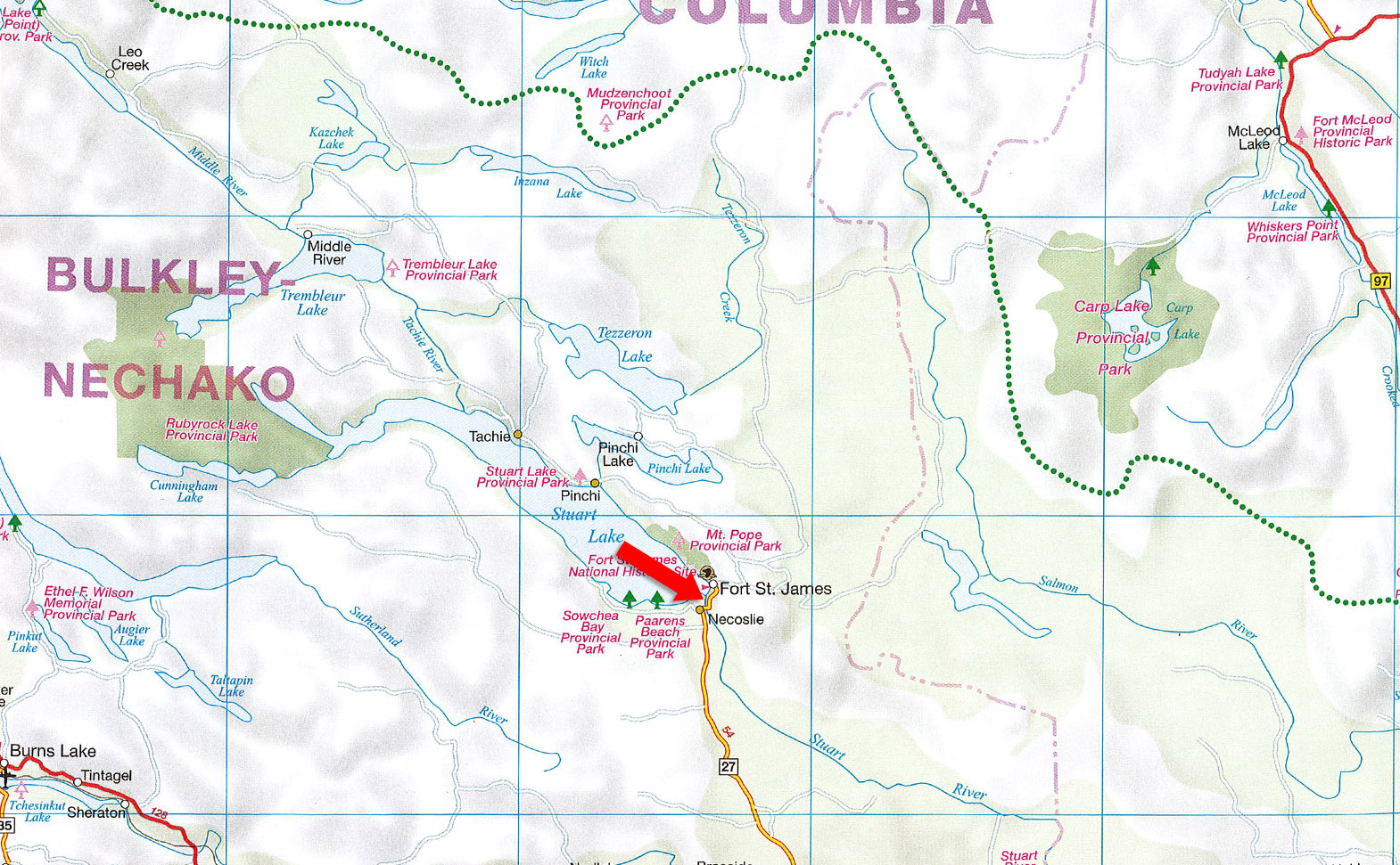
From Sowchea Road turn right on Sweder Road approximately 300 m, Fort St. James.
From Prince George head west on Highway 16 and a few kilometres past Vanderhoof (approx. 1 hour) turn north on the Fort St. James Highway for a scenic 45-minute drive to Fort St. James.
Aspen, willow, pine and fir.
Year-round outdoor and indoor recreational opportunities include hiking and biking trails, soccer and ball parks, golf, fishing, hunting, water-skiing, canoeing, swimming, sailing and boating, alpine and Nordic skiing, skating, hockey, curling, snowmobiling, dog sledding and camping. Cultural opportunities include a Public Library, the Community Arts Council, an amateur theatre company and a movie theatre.
Founded by Simon Fraser in 1806 on the shores of beautiful Stuart Lake, Fort St. James is the gateway to a chain of rivers and lakes that traverse 400 kilometres of central British Columbia. The population of the Fort St. James area, including the municipality itself, rural areas and First Nations, is approximately 4,500 people. There is an established forest industry, a growing mining sector and a growing tourism industry.
Few towns are more proud or more aware of their history. The Fort St. James National Historic Site, the ancient burial site of Carrier Chief Kwah, Our Lady of Good Hope Catholic Church, and the monument to legendary bush pilot Russ Baker are of great interest to residents and visitors alike.
Please see mapping section (all boundaries are approximate).
54°25'37.06"N and 124°16'43.62"W
Available Hydro, telephone and Natural Gas.
None.
Split Zoning. R4 - Waterfront Residential and H1 - Small Holdings.
Lot: 9; Pl: PRP1333; DL: 1268; LD: Coast Range 5 (14); Range: 5
PID 012-798-371
Lot: 10; Pl: PRP1333; DL: 1268; LD: Coast Range 5 (14); Range: 5
PID 012-798-398
Lot: 11; Pl: PRP1333; DL: 1268; LD: Coast Range 5 (14); Range: 5
PID 012-798-401
 +8 maps


Our property descriptions and geographical information are taken from the BC Assessment Authority, Land Titles Office, government maps and other sources. While LandQuest® does not guarantee the information, we believe it to be accurate, but should not be relied upon without verification. This communication is not intended to cause or induce breach of an existing agency agreement.
Fort St. James
 11℃
4℃
11℃
4℃